Other Sections:
Part 1 – Tour Aotearoa – North Island
Part 2 – Tour Aotearoa – South Island ← You are here
Part 3 – Alps 2 Ocean – Bonus Section
Day 16
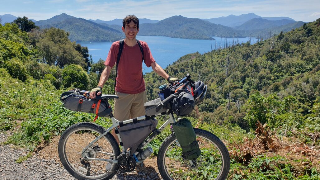
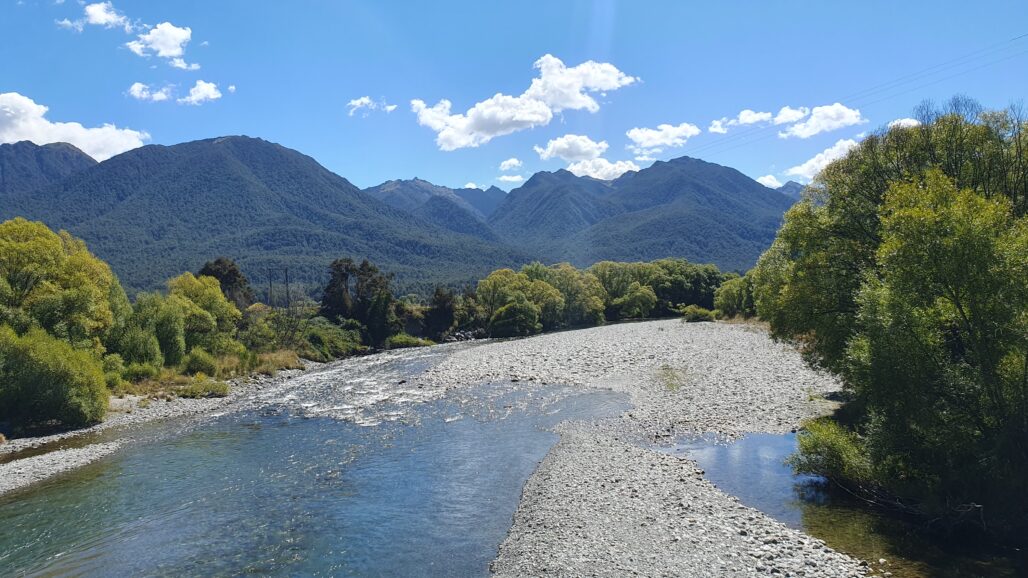
Shorter distance today because we had a late start due to crossing the Cook Strait to the South Island in the morning. The beginning of the route was up a windy mountain road with all kinds of beautiful look outs over the sounds like this one. It was really an incredible area and I could have chosen a dozen other pictures for the day but this was the best one with me in it.
Day 17
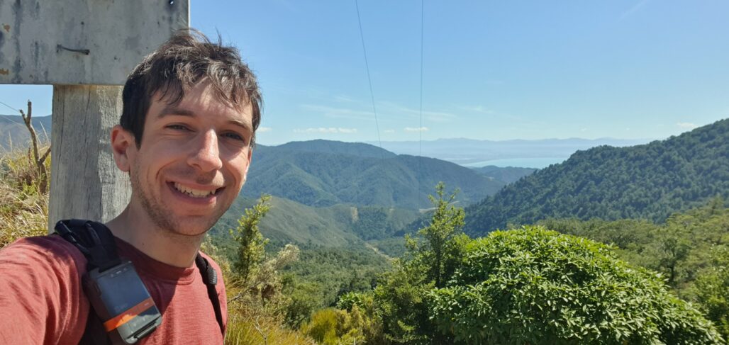
On the route I’m taking, this is known as one of the most hated sections – the Maungatapu Track, or as it’s known locally, “The Maunga-fucking-tapu”. It’s a 12km slog along a ridiculously steep and rough 4WD track over a mountain. Reaching the top was a struggle using all my effort just to push the bike up the steep grade. Here I am at the top thinking the worst is over, not realizing the terror of 25% grade downhill over large, loose stones. Never in my life have I walked my bike so far downhill. I think out of the 12 km track I probably only rode about 2 km. Glad I did it, won’t do it again haha. I was hoping to put in a bit more distance but underestimated just how long that 12 km would take (~4.5 hours)
Day 18
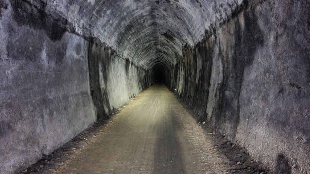
Back on nice trails after the difficult day prior. This ride had little climbing but had interesting points such as this almost 1 mile long tunnel only for bikes and walkers. Originally a train tunnel, that train is no longer operating. It’s so long that from the center if you turn off your lights it is pitch black and you can’t see either exit.
Day 19
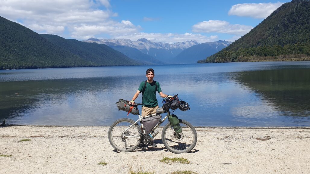
This was a pretty cool day with some nice rural gravel roads and nice scenery. The highlight was here at Lake Rotoroa. With the mountains in the distance it really reminded me of Lake Louise at Banff in Canada. It’s a shame cameras can’t really capture the beauty of a place like this! The only drawback is the number of sandflies here. Those things are my new worst enemies. They are like mosquitos but worse and quickly swarm you if you aren’t moving. After a short stay at the lake I got back on the bike to run from them.
Day 20
The next section of the ride was a 122 km gap of nothing from where I was to the next town. My goal was to do the entire thing in one day, making it the longest of the trip. Unfortunately some of the gravel roads along the way were pretty loose and slower than I was hoping for. After 80 km I had the option to stay in at an Airbnb or ride 44 km further over a big mountain. My legs were in pain so I opted for the Airbnb. This turned out to be the correct move because the room had a massage chair in it that I got some great use out of.
Day 21
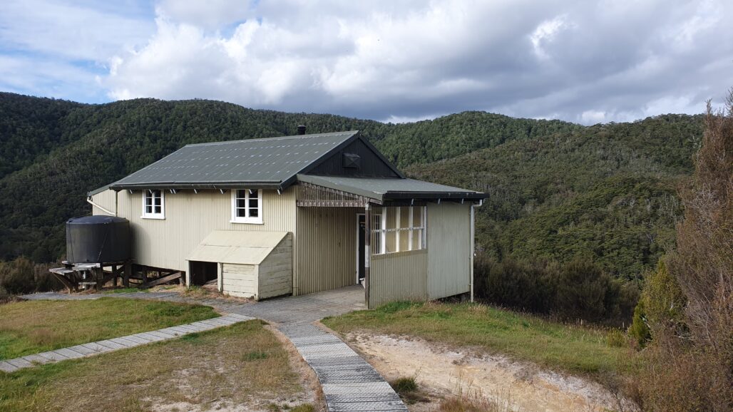
Remember a few pictures ago talking about that 12 km hated 4WD track? That’s not considered the hardest section of the route. THIS section is, known as Big River. It starts out on another rough 4WD track and climbs up a mountain of comparable size to Maungatapu. While it wasn’t quite as steep and rough, there were a lot of deep puddle and river crossings to navigate which made for another slow ride up. At least this one could be called a ride. Around 5pm I arrived here to Big River Hut, a remote little building with 20 beds inside for hikers or bikers to use. There’s no cell service up here, and I was the only one in the hut that night. After a good night’s rest I would continue to the hardest parts of Big River.
Day 22
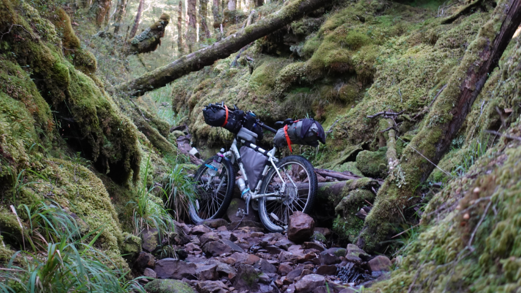
This picture just speaks for itself. That’s not a random riverbed, that’s the trail! It took about 4 hours to go 10 km / 6 mi through the rough track. It was much more rideable than Maungatapu, but the problem were the obstacle sections. From this riverbed, to a washout with a huge drop, to huge fallen trees blocking the way, it was a slow grind. Each obstacle was more difficult than the previous ones. I had to lift up my bike over trees, squeeze it under small gaps of larger trees, and carry it over streams and big falls. What a day. Truly epic views back there though. I’m glad I got to experience it, but next time I’d hike it without a loaded bike though!
Day 23-24
I took the first 0 day of the trip due to a storm rolling through. The next section of riding would be along the highly rated West Coast Wilderness Trail, so I wanted to experience it in good weather. I booked a single room at a hostel for 2 nights in Greymouth to wait out the storm.
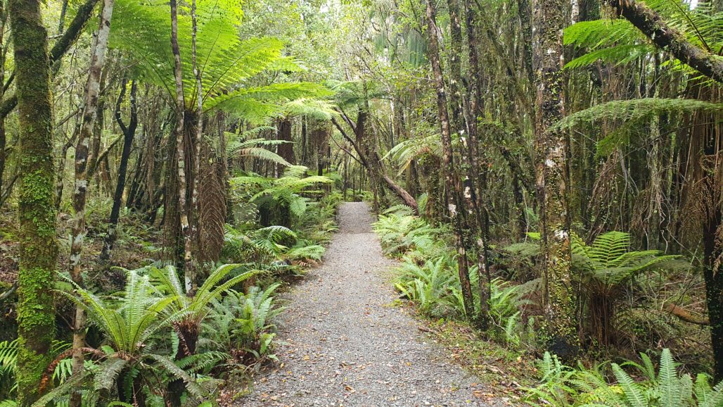
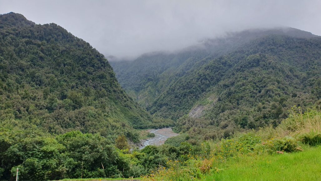
The next day I set off along the trail. The weather wasn’t perfect; it was cloudy and foggy so visibility in the mountains was low. A good chunk of the trail went through thick rainforest like this picture while the rest offered potential mountain views that were obscured by the clouds. This ended up being one of my favorite trails despite not seeing the mountains.
Day 25
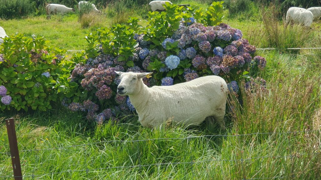
It’s been a while since we’ve had a sheep picture, and I liked this one with the blue flowers behind it. This day I finished off the West Coast Wilderness Trail with similar weather. It was sunny along the coast but the mountains remained hidden in clouds. The forecast called for some clear days soon, so I wanted to cover enough distance to get to Mt Cook and Fox Glacier for the clearest days. Doing so meant putting in pretty big daily distances despite lots of mountain climbs.
Day 26
Continuing towards Fox Glacier, this picture was taken along a final triple mountain pass to reach the small town. This part of the west coast was super touristy. There aren’t many locals that live here and you have to pay a premium for everything at supermarkets. The North Island was packed with free campsites, while the cheapest accommodation I could get this night was a $25 tent site! I went to bed in my tent in front of mountains covered in clouds.
Day 27
From here out picking a picture of the day became nearly impossible. If I were to choose my 20 best photos of the entire trip, 15 or more would have come from these last days. BUT the rules are the rules. Just one picture per day.
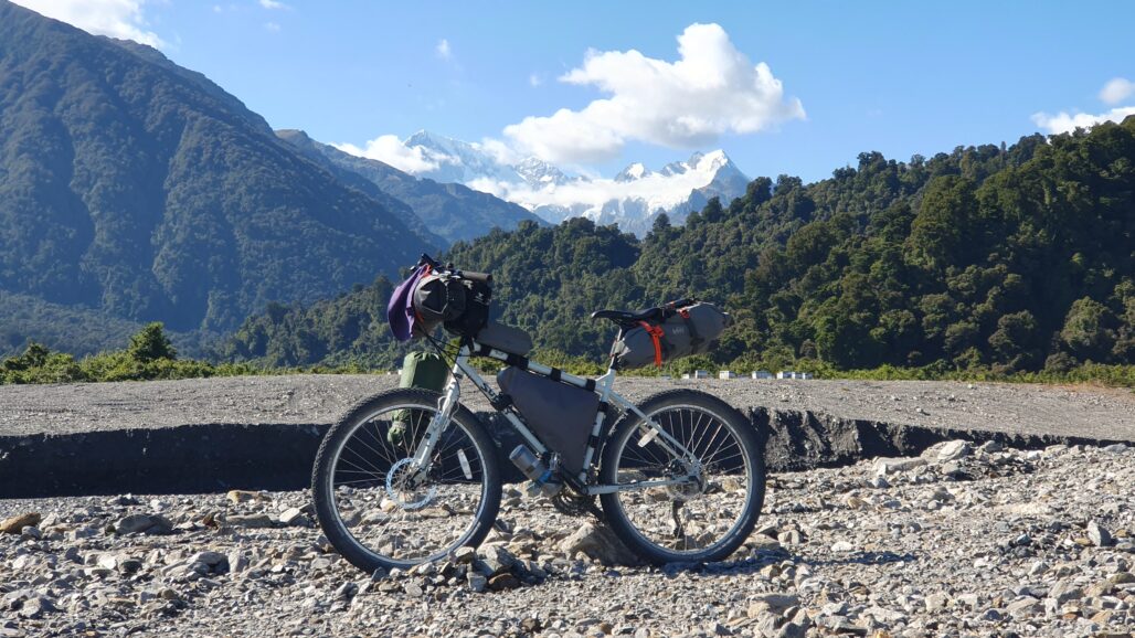
This morning I woke up to see that all the clouds had cleared out and I had views of Mt Cook, the tallest mountain in New Zealand for the first time. This mountain, and others in the region, is covered in glaciers year round. It’s the end of summer in the southern hemisphere yet it remains covered in snow and ice. For the entire day I enjoyed epic views of snow capped mountains now visible for the first time in days.
Day 28
At this point the weather forecast was pretty clear – a huge storm would be coming through in about 4 days. Based on my current progress I figured my best bet to ride out the storm with a roof on my head was to reach Mossburn where there is a cheap hotel. The next big town coming up was Queenstown, the tourist capital of NZ where even a tent site costs over $40. Well, as it turns out there is a big race event this weekend in Queenstown and all the accommodation within my budget was booked out. Okay, so Mossburn in 4 days or bust. Let’s go.
This picture was taken on the way up towards Haast Pass. I had a nice tailwind pushing me up over the pass making the ascent pretty easy. You can see in the picture all of the dust kicked up by the wind. I had partly cloudy skies, but it was clear enough to see the snow capped peaks of Mt Aspiring National Park. I stayed at a campground with some of the best views I’ve ever seen.
Day 29
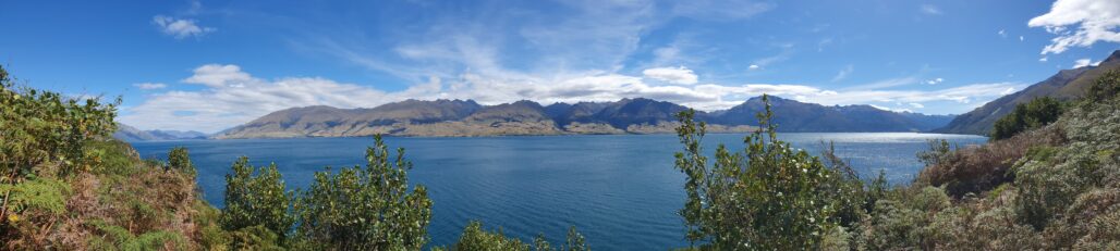
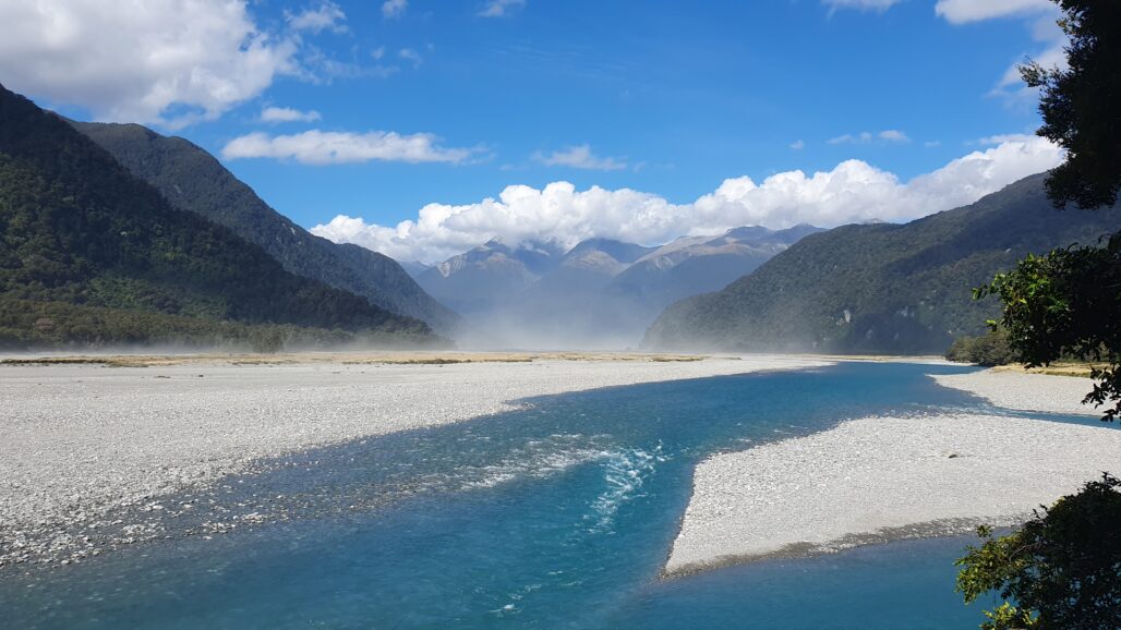
Yeah, that’s right, we’re using a panorama for this one. After cresting over Haast Pass I rode through the Queenstown Lakes District, where ancient glaciers have carved out massive, bright blue lakes. The majority of this 100 km day was done along these lakes with views just like this picture. I also finally finished the section of my route that’s on a busy highway and joined up a cycle trail for the first time in days at the end. Nice.
Day 30
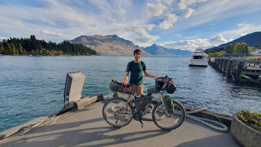
This day started with the biggest climb of the entire trip up to the peak of the Crown Range at over 1,000 m / 3,000 ft. The peak offered incredible panoramic views of Queenstown and the surrounding area. A nice descent on cycle trails that included a section where I had to ride straight through the kids race of the big event this weekend landed me in Queenstown itself. This bustling city is jam packed with tourists taking in the impressive views and participating in all kinds of outdoor activities. Truly an incredible place, but also an expensive one. Because I couldn’t get accommodation in town, I took the TSS Earnslaw, a 100 year old steam boat, across the lake to a free, quiet campground that night. The ride was incredible and the boat impressive. This picture is waiting for the Earnslaw to come.
Day 31
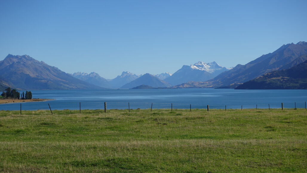
Departing from my campsite, the plan for the day was to tackle the 100 km Around the Mountains trail and arrive in Mossburn to the hotel I booked before the storm rolled through. It sounded easy enough, but when the views looked like this it was so hard not to just stop and take it all in. I easily could have just stayed there all day, but then I’d be caught out in the storm. This picture is looking across Lake Wakatipu to Mt Aspiring. After a difficult morning including a steep climb I was blessed with a massive tailwind to push me into Mossburn where I enjoyed the most comfortable bed of the trip.
Day 32
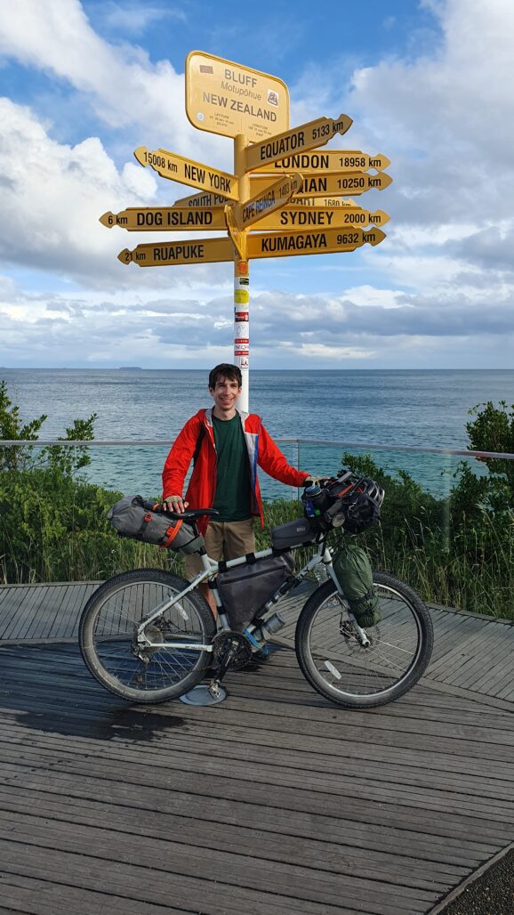
That massive tailwind I mentioned in the last picture? Yeah that’s sticking around for another day. With no climbs left on the entire route, a goos tailwind, and a section with relatively uninteresting scenery it was clear that I would push through the longest daily distance of the trip to the finish line. Leaving Mossburn I did get some pretty cool views of the tall mountains that received a fresh coating of snow in the storm that night, but a photo at the finish line has to be the picture of the day by default. Here I am at the Bluff sign post, one of the southernmost points on the South Island of New Zealand. It was an amazing journey and I’m so glad that I took the opportunity to come here on a last minute yolo. I still have a week left in NZ, so while the main cycle route is complete the journey doesn’t end here.
Part 1 – Tour Aotearoa – North Island
Part 2 – Tour Aotearoa – South Island ← You are here
Part 3 – Alps 2 Ocean – Bonus Section