Hiking Seoraksan in winter always sounded like an exciting challenge to me. During my winter vacation in 2021 traveling outside of Korea was impossible due to COVID-19 and the mandatory 14 day quarantine upon returning, so I had a perfect opportunity to attempt this challenge. Instead of one of my usual trips to another country, I decided to take a week in January to go on a hiking trip to climb some of the highest peaks Korea has to offer. The idea was to visit one national park every day for five days and to climb to the highest peak in each park. I would start at the far northeast corner of the country at Seoraksan National Park and work my way south. I had summited the mountain once before during the peak fall colors in 2019, but hiking Seoraksan in winter would prove to be a whole new challenge.
Hiking Seoraksan in Winter
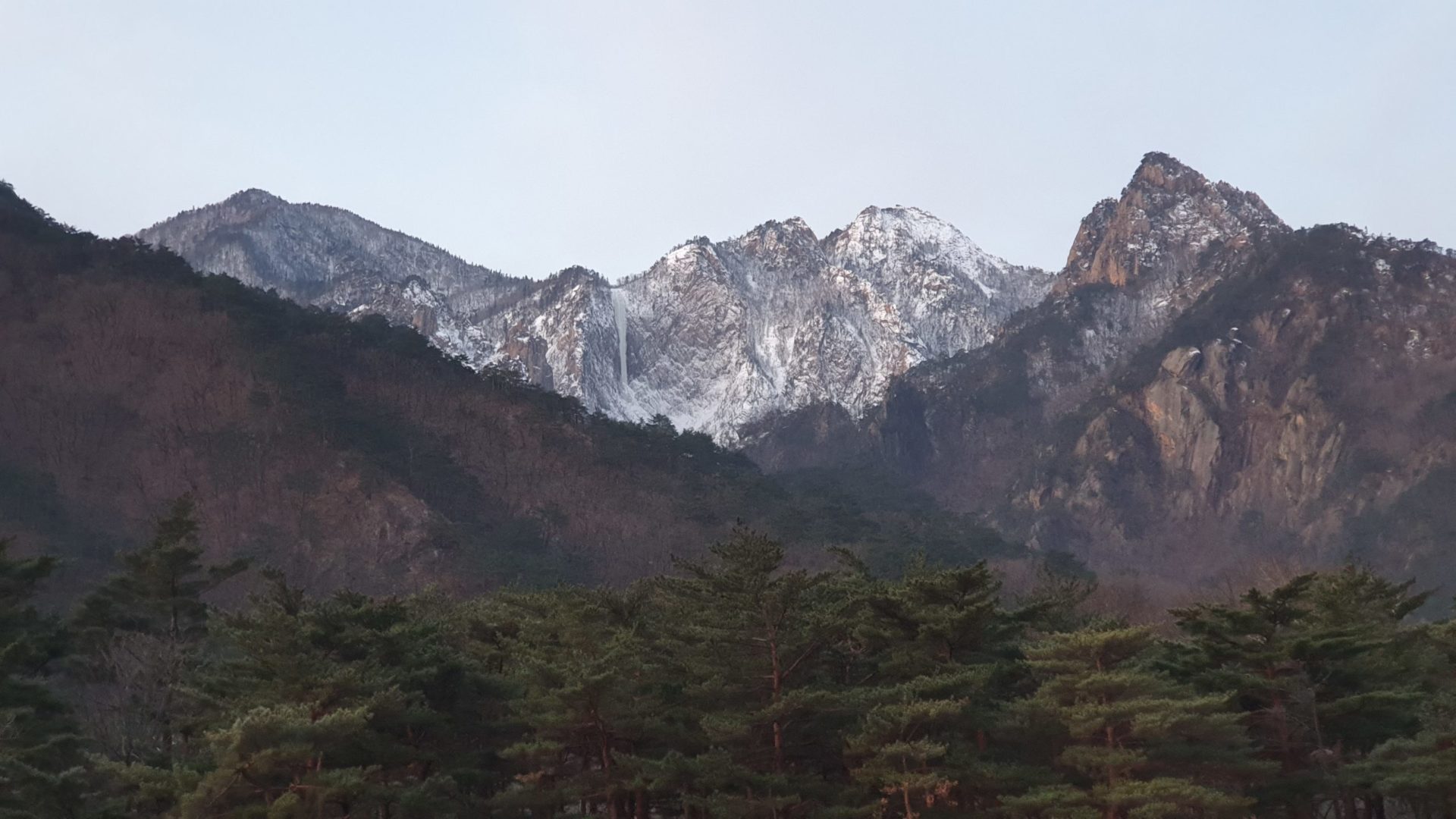
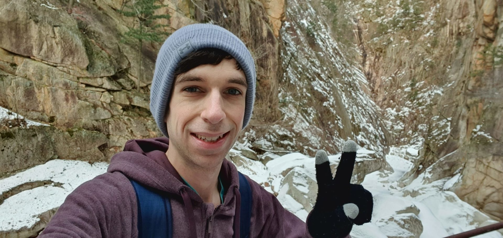
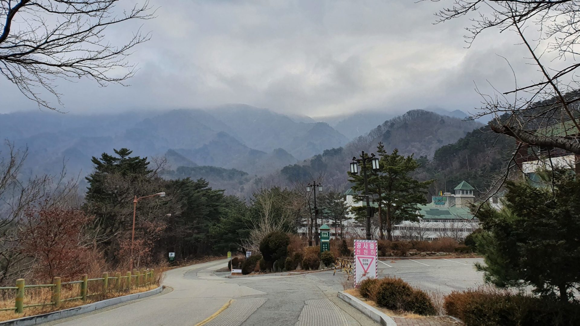
First on my list of national parks on this trip is Seoraksan. At 1708m elevation, Seoraksan is the third tallest mountain in Korea. When planning to hike Seoraksan in winter you must accept the inevitable cold and snowy weather, but all things considered I could not have asked for a better weather for a late January day. The air quality was great, there was no wind, skies were clear, and the high temperature was around 48°F / 9°C. Not only that, but the day before saw a few inches of fresh snow dropped on the mountain which promised to make this hike extra beautiful.
Traveling to Seoraksan National Park
Getting to Seoraksan from my home in Daejeon is just about as far away as you can possibly be on mainland Korea. There’s no direct buses, so I had the choice to either connect through Seoul or through the city of Gangneung which is an hour south along the coast. I decided to go via Gangneung so that I could get some ocean views along the way.

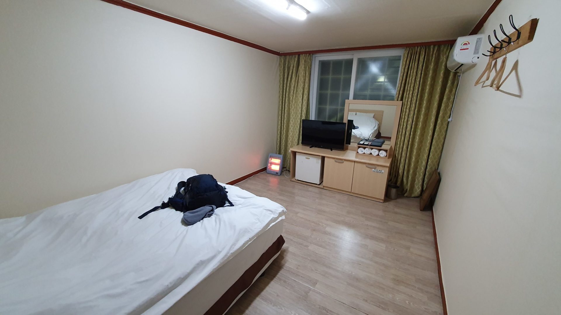
Seoraksan National Park is the second largest mountainous national park in Korea, so you have a few options on which side of the park to begin your hike from. Each section has its own selection of hotels and places to stay nearby, but I chose the main entrance on the east side. There is a long road leading up to this entrance with plenty of hotels that is serviced by Sokcho city buses 7 and 7-1 which run very frequently. I finally arrived in Sokcho at around 3:00 p.m., so I spent some time exploring Sokcho Beach before grabbing dinner and taking a city bus towards the park and to my hotel. Coming in on a Sunday night deep into the off season, there was plenty of vacancy at all the hotels, but if you are coming during the peak fall colors in October it would be best to book well in advance. With everything available I made the easy choice to pick the cheapest accommodation within walking distance of the park entrance. Being so close to the park entrance was important to me; the hike to the summit is about 11 km / 7 mi one way so I planned to start the hike right at sunrise.
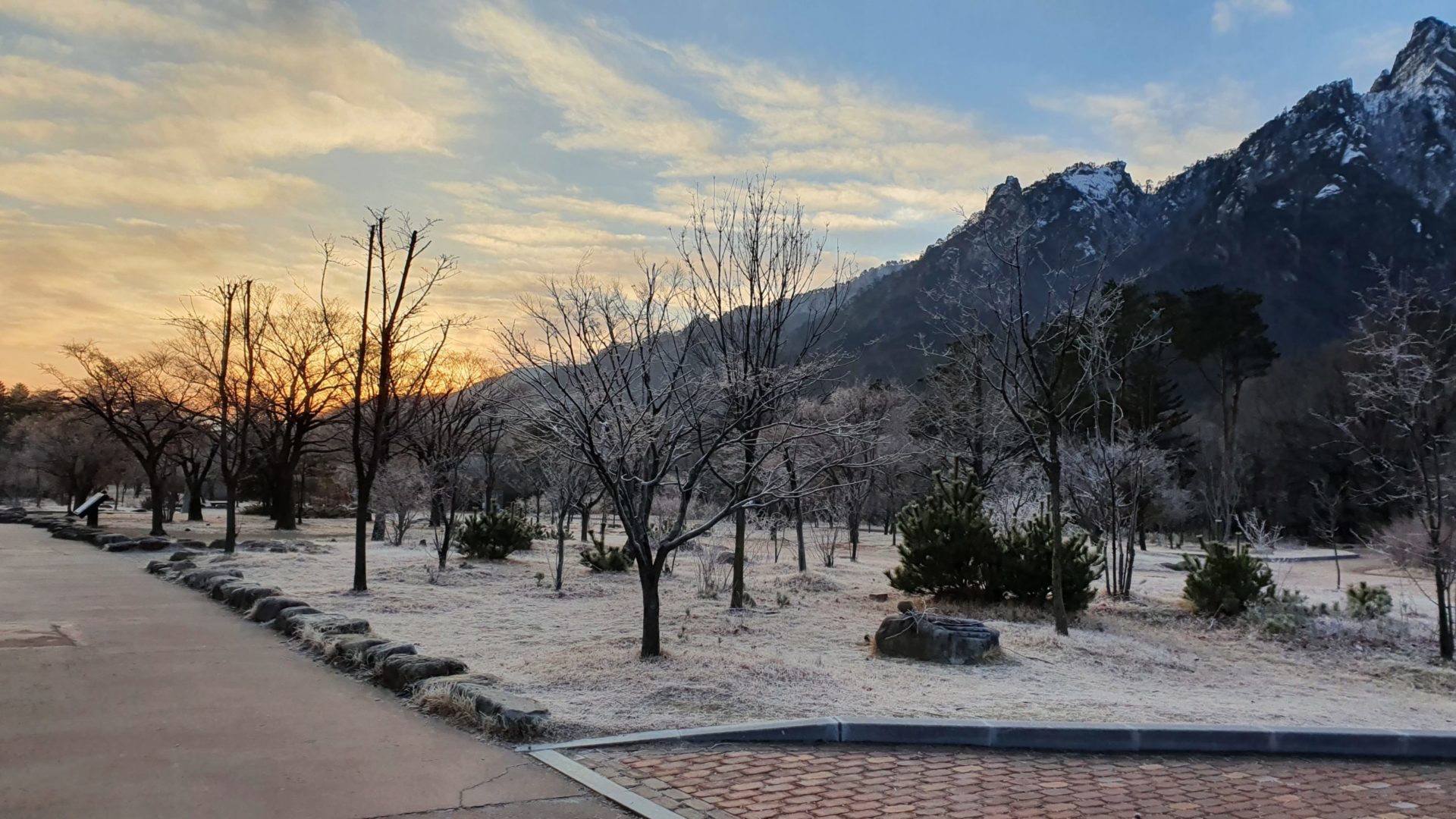
I woke up early the next day at 6 a.m. and ate a large breakfast before packing all of my things and setting off on the hike. Even in the morning it wasn’t too cold, and just after a few minutes of walking with my heavy backpack I already took my coat off. I arrived at the main parking lot to see just two cars parked, one of which I assume was the worker at the ticket booth. This was a good indicator of the amount of people I would see on the trail throughout the day!
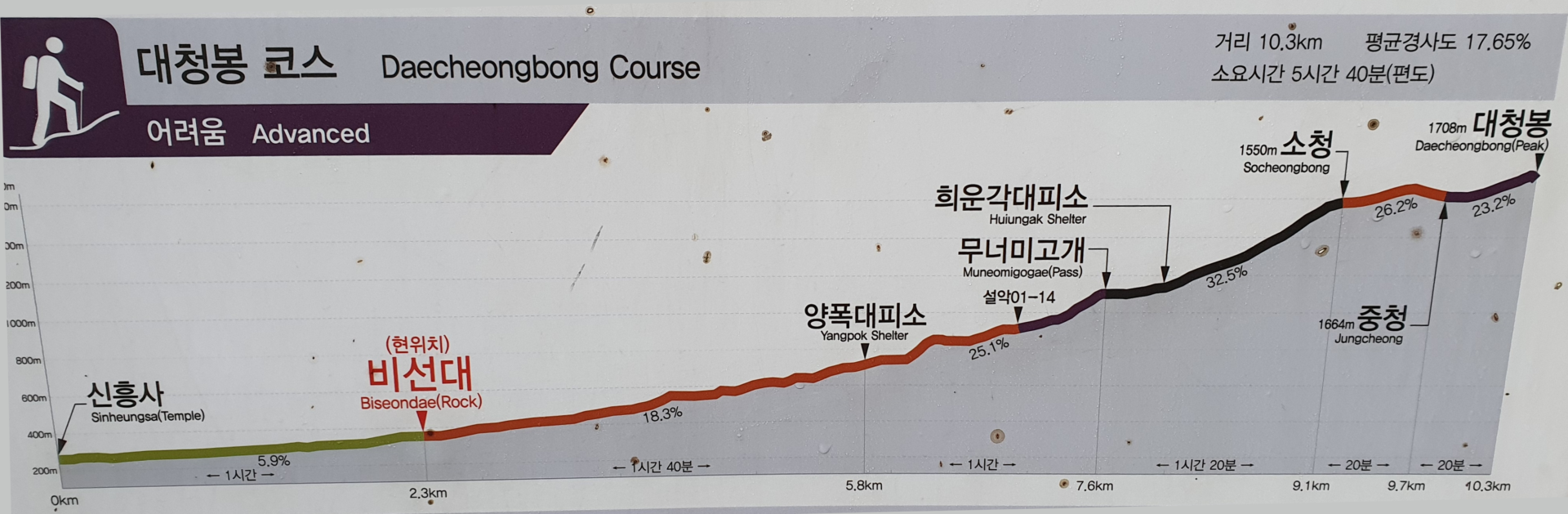
The planned route for the day was to walk the “easy” path 3 km to Biseondae, begin the elevation gain with a “moderate” ascent 5.3 km to Muneomigogae, continue on the steep “expert” 1.5 km climb to Socheong peak (1550m elevation), finally reach the peak after the last “advanced” 1.2 km push to the summit at Daecheongbong (1708m). After enjoying the views at the summit I would descend 5 km straight to the Osaek Bus Terminal where I could hop on a bus to head to my next destination: Odaesan National Park.
Hiking to Biseondae
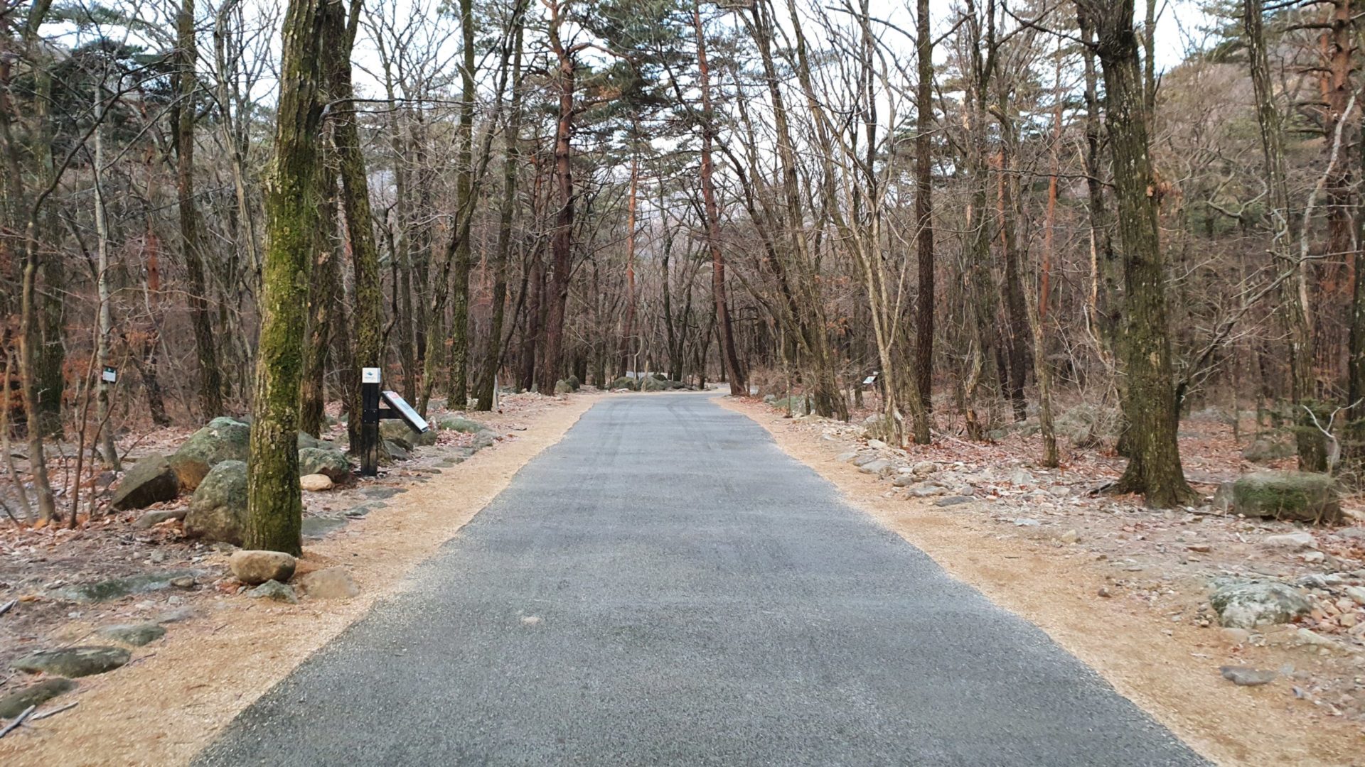
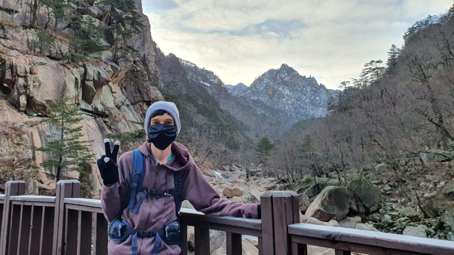
Biseondae is a large flat rock located in a valley along a river. The walk to reach it is extremely easy but provides a few good views of the surrounding mountains. Due to time constraints I walked pretty fast to cover as much ground as I could before the terrain gets more difficult. The sun sets at around 5:30 p.m. in January at Seoraksan, so I wanted to be sure I had time to make it down the mountain before dark. The elevation gain en route to Biseondae is minimal, so it is a popular walk among inexperienced hikers. During peak seasons this trail tends to be pretty crowded, but on my entire walk I didn’t see a single other person until I reached Biseondae itself.
Ascending to Muneomigogae
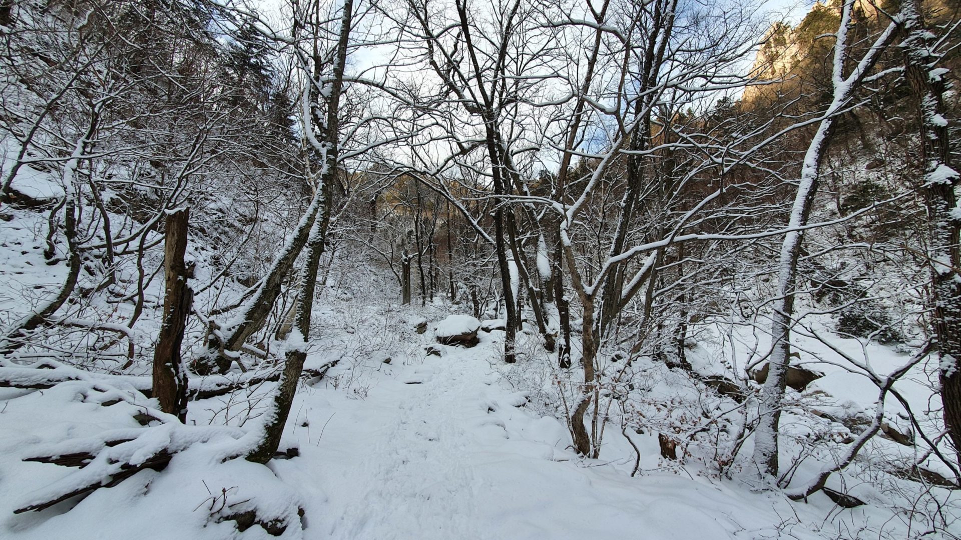
After leaving Biseondae behind, the real ascent begins. The flat paved trail turned into a walk along boardwalks that continue along the river as you enter into a canyon with steep cliffs on both sides. Down in this canyon the sun is blocked out by the cliffs which allowed the snow to accumulate without melting. As I continued up the canyon the elevation quickly rose and the snow depth increased. Snow and ice soon covered the trail, so I needed to put on my snow cleats to continue.
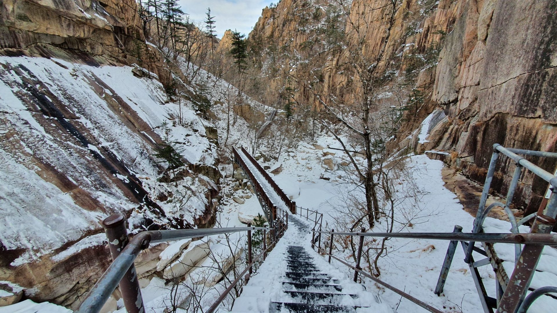
For about an hour I continued the hike up the canyon until I arrived at the first shelter. The map I saw earlier had estimated that it would take an hour and forty minutes to go this distance, but I was walking fast to cover as much ground as possible before the trail gets steep and my pace is forced to slow. Here I saw the first other hikers since Biseondae – a group of two others who were descending the mountain. I’m guessing they might have spent the night at a higher up shelter and were coming back down this morning after enjoying sunrise from the summit. I guess I’m not the only one crazy enough to climb Seoraksan in winter after all! After a quick break here to use the restroom I was ready for the next section of the hike. From here out it gets much steeper and the elevation quickly rises.
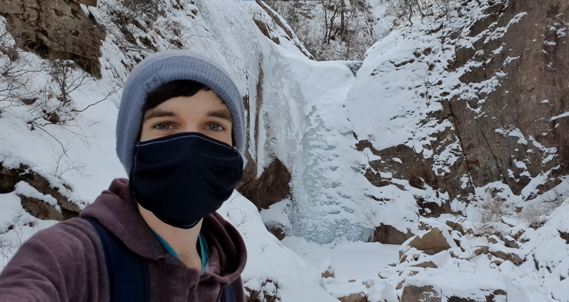
While the snow depth did increase as I climbed in elevation, it wasn’t enough that the frustration of walking in the snow was worse than the joy of seeing the beautiful snow covered trees. I was really happy to have the opportunity to do this hike in the winter just after a fresh snowfall. It really did add to the beauty of everything.
After another hour of hiking since the shelter, I finally arrived at Mineomigogae. Gogae (고개) in Korean means mountain pass, so this is the point where you finally climb all the way out of the canyon. From here the beauty transitioned from snowy trees to epic mountain landscapes. From here there are no more cliffs to block out the sun, and so the snow depth decreased and the weather felt much warmer. I even ended up taking off my sweatshirt and doing the next section with nothing but a t-shirt. I was so lucky to have such beautiful weather in the middle of January.
Hiking to Socheongbong
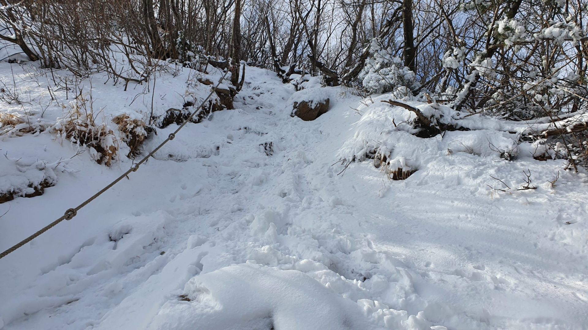
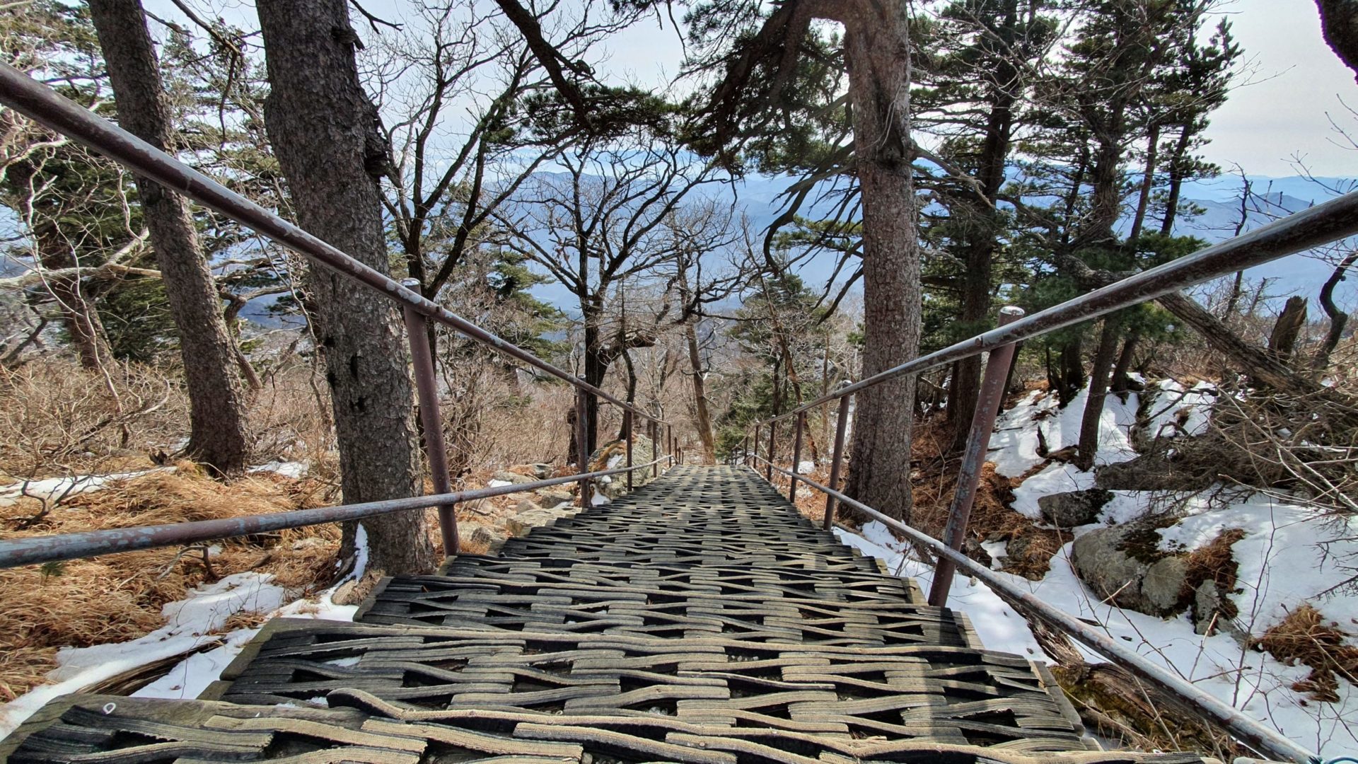
I thought that after being in the sun that I would be done with the snow from here out. I was wrong. Eventually the elevation once again won the battle over the sun, and the level of snow accumulation was higher than ever. In addition to that, the trail continued to rise steeper and steeper as most do on Korean mountain paths. Some really steep sections became difficult to climb and even felt a little bit dangerous. Normally on hikes you hate to see sections with lots of regular stairs, but this time around I preferred them because the snow didn’t build up on them like it did on regular steep ground! There were only a couple difficult sections in the snow, and once I got over them the views became more and more spectacular.
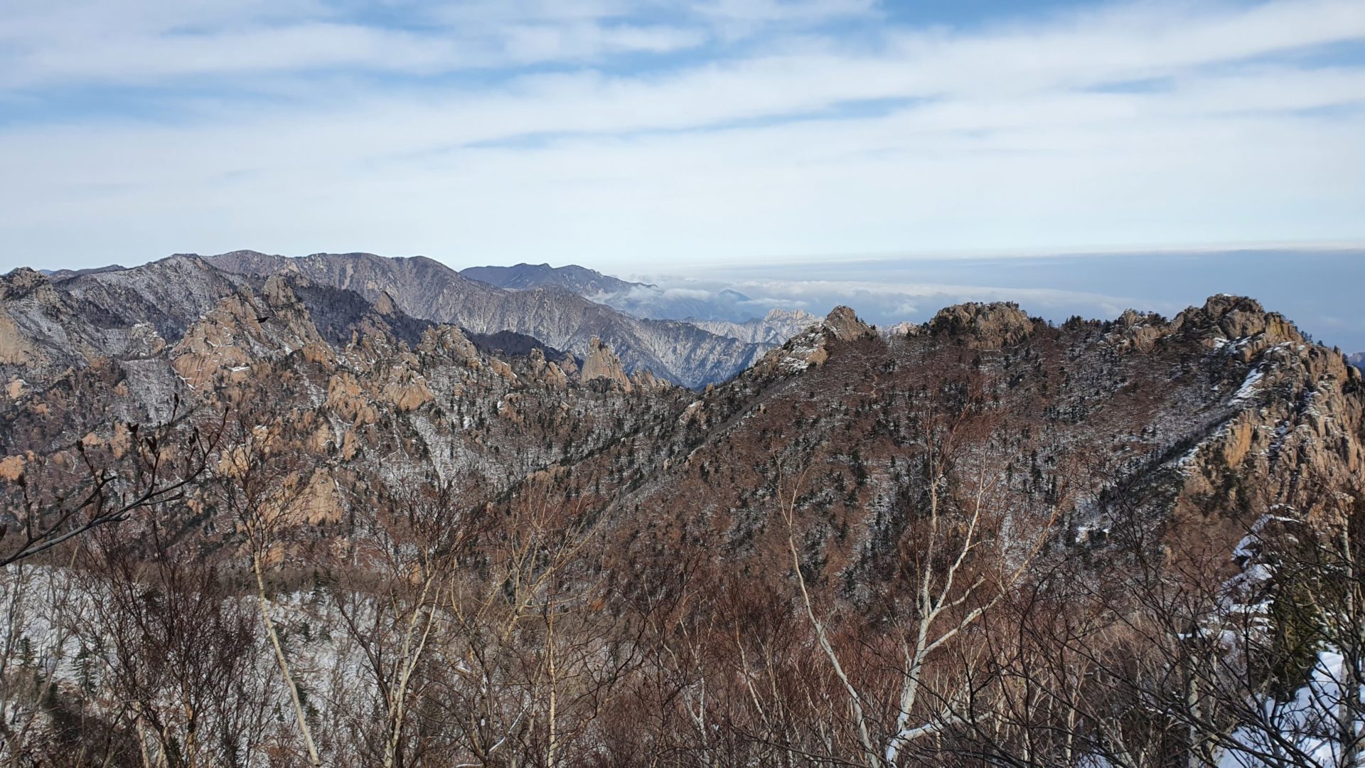
In 2018, my first year in Korea, I came to Seoraksan to do some hiking. I was inexperienced and a bit out of shape, so I wasn’t ready to attempt the summit. However, I did go up to the Ulsanbawi, a rock formation at an elevation of 873 m / 2864 ft. Back then I thought it was a difficult trail with a high elevation, but now as I stood upon the ridge just over a kilometer from the peak I was looking down at these tiny rocks when I realized that that’s where I was back in 2018!
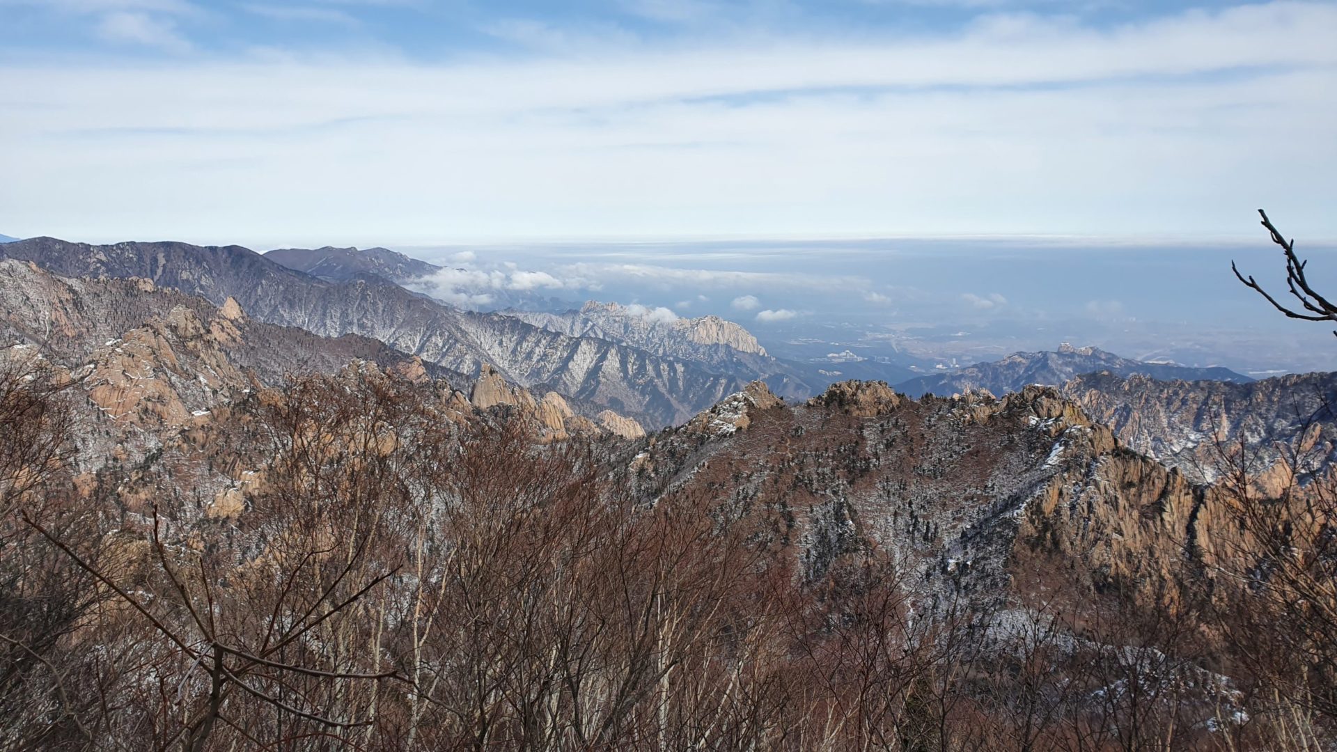
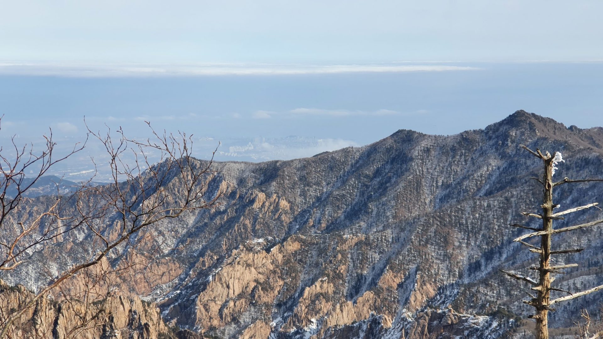
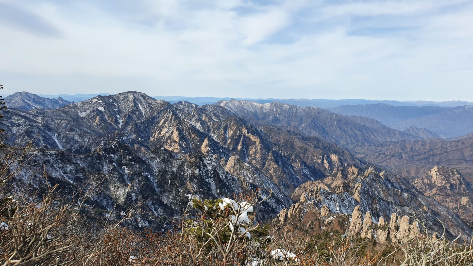
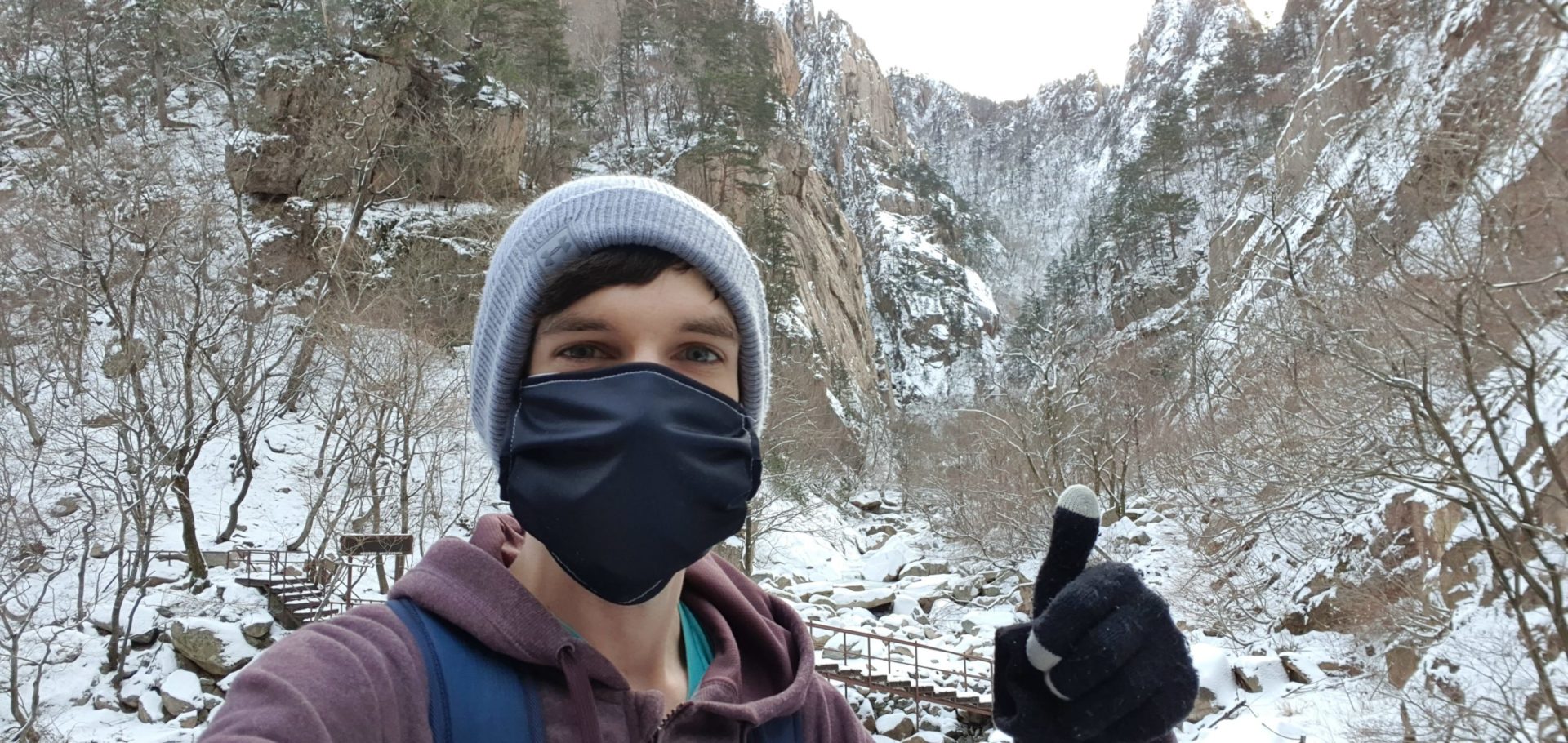
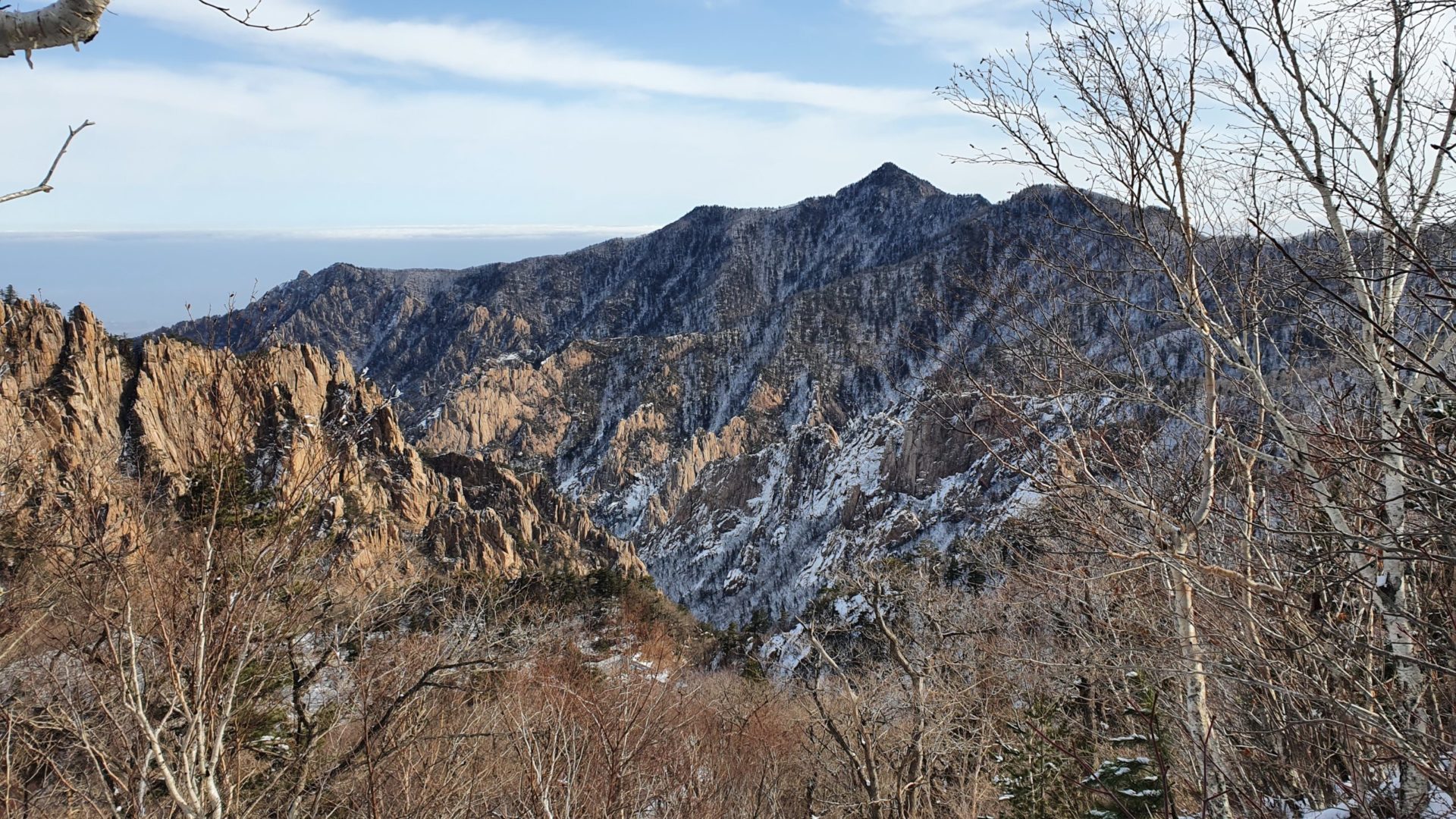
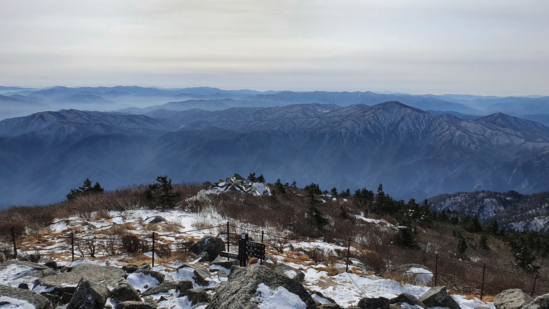
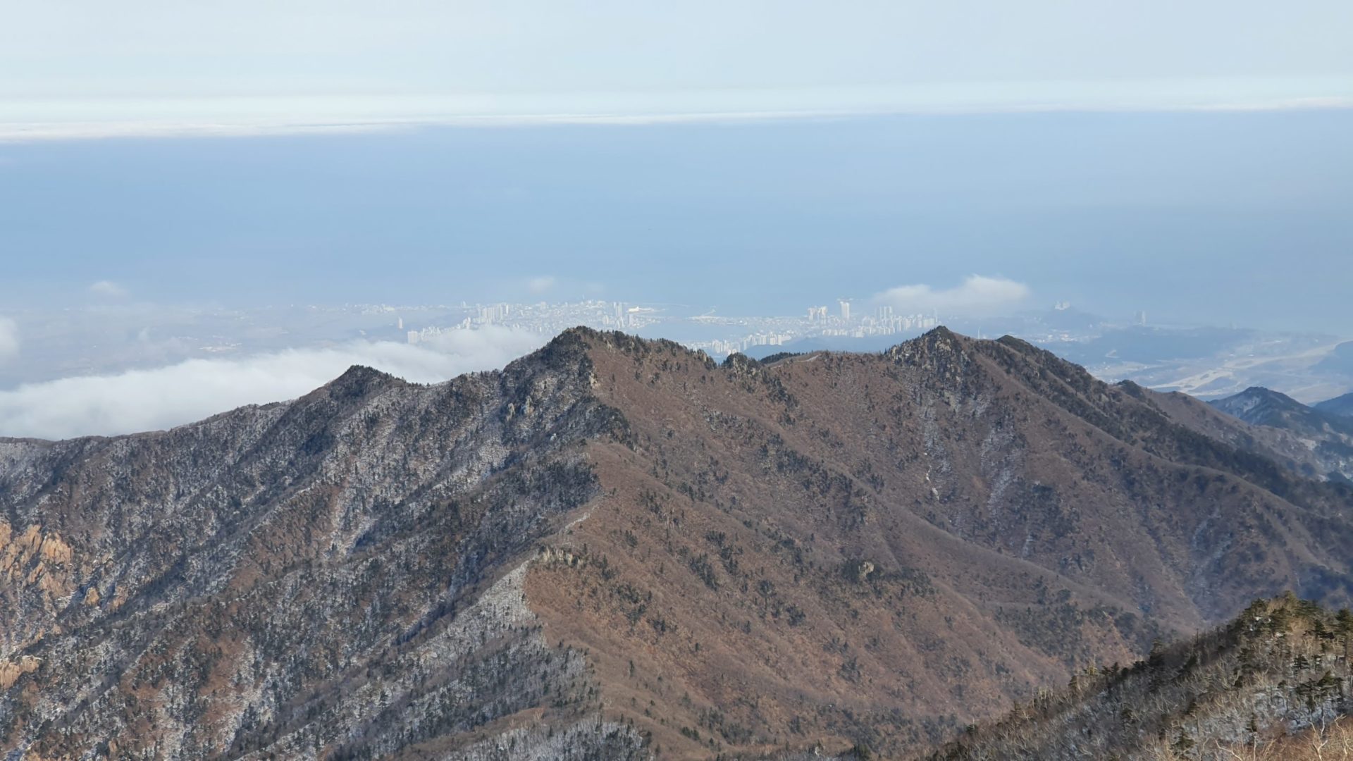
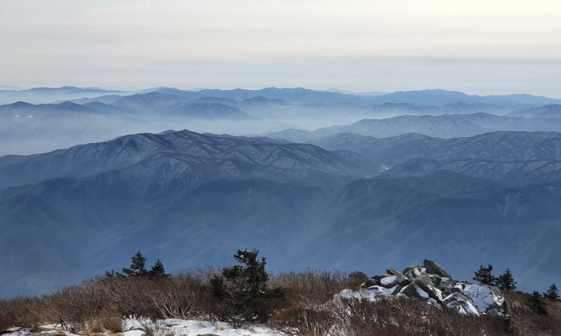
Once I came to the top of this ridge I arrived at Socheongbong, the last peak before the final ascent to Daecheongbong. From here I could finally see a 360° panoramic view of the entire park! Oftentimes in the winter in Korea there is some level of air pollution that prevents you from seeing too far into the distant mountains, but today was an exception. The air was clean and I could see for miles in all directions. Besides the incredible views, I finally saw the first other hikers since the first shelter two hours ago. From this point on there was a decent amount of traffic. I think many of them either stayed the night in the shelter or came up from the south side of the mountain. That route is much faster at only 5.4 km each way, and it would be the way I would go down the mountain.
Hiking to Daecheongbong
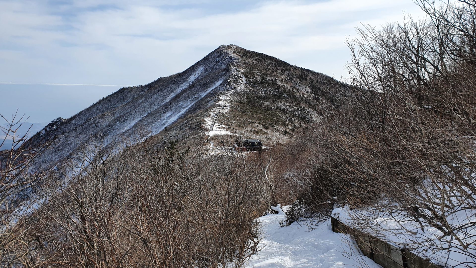
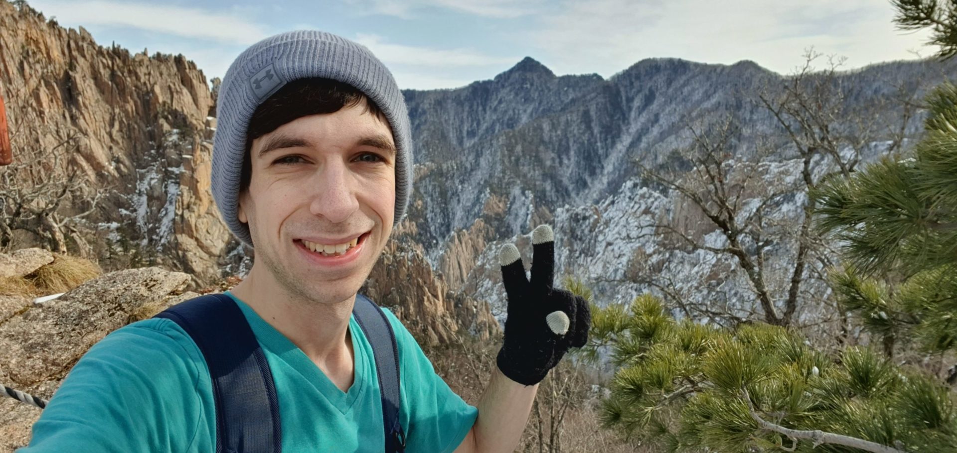
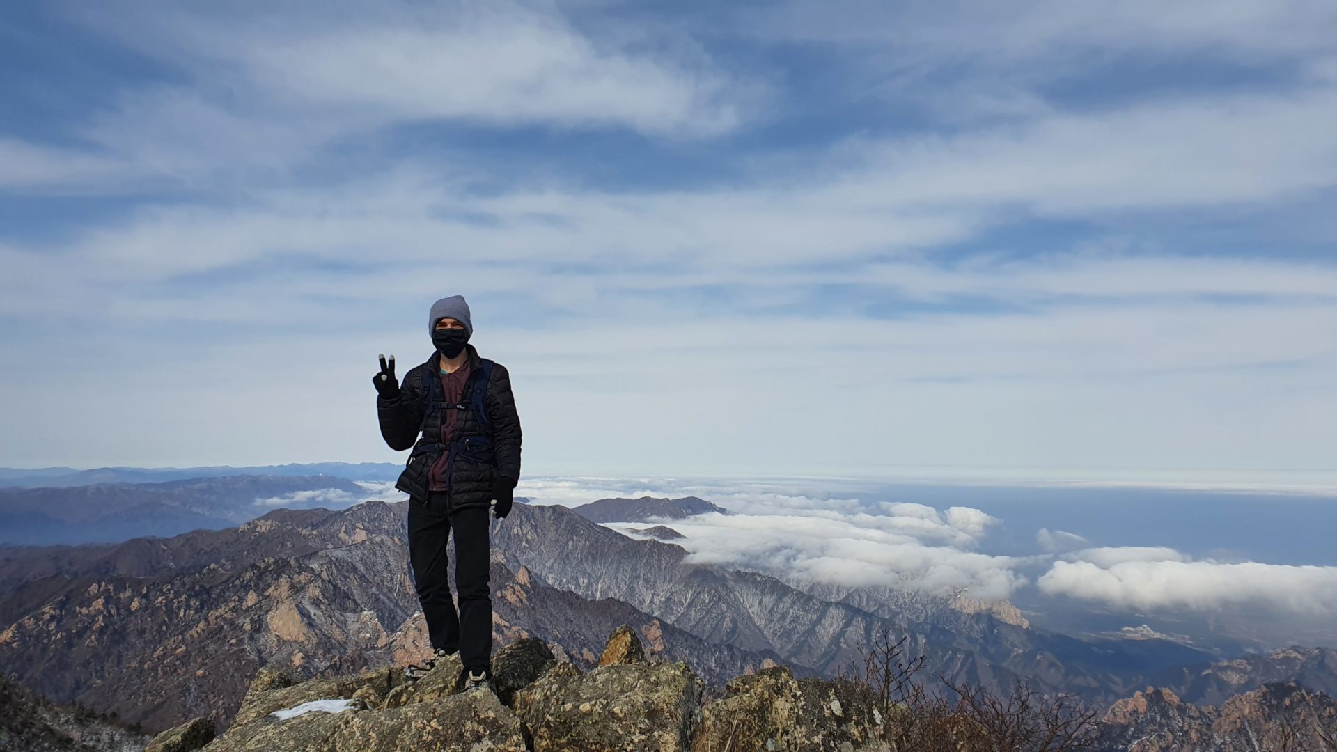
There was one final shelter just below the peak. At this point it had been almost 6 hours of hiking since I ate breakfast, so I stopped for a quick snack before finishing the ascent. I ended up reaching the summit at 12:45 pm after starting my hike in the morning at 7 am. It was a long way up, but the views were great at the snow was beautiful. Climbing Seoraksan in winter was my favorite hike I’d ever done in Korea, and one that I would recommend to any experienced hikers who want to see some of the most incredible views in the country and don’t mind a long and strenuous climb.
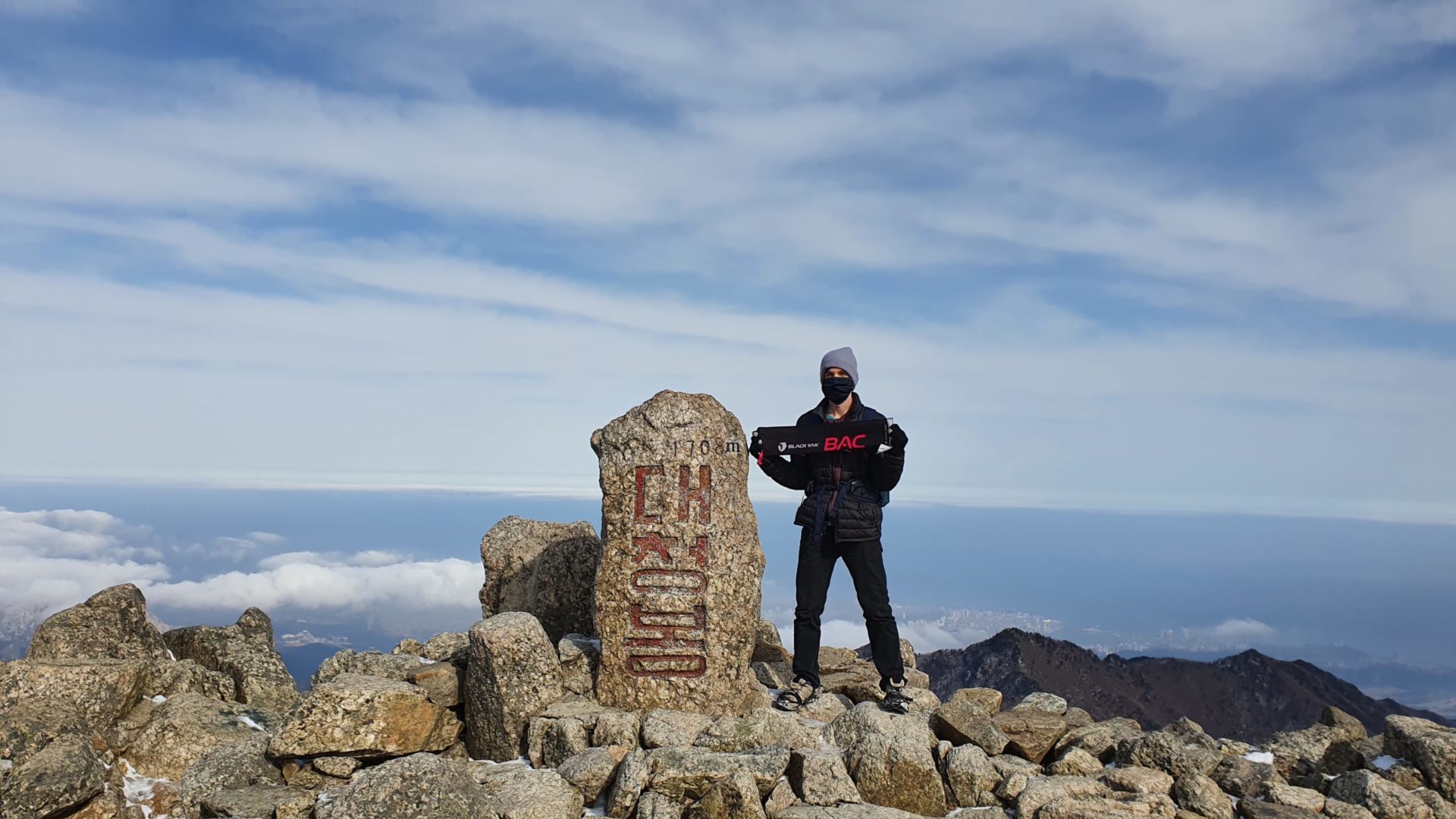
For those unfamiliar with the Black Yak towel, Black Yak is a brand of outdoors clothing and hiking gear that puts on a challenge known as 블랙야크 100대명산, which translates to “Black Yak 100 Famous Mountains”. Through a mobile app you certify that you submitted each of these mountains using GPS and with a picture holding their towel. After you climb enough peaks you can earn rewards and completion medals. Unfortunately it is only available in Korean, so if you can’t read Korean it is difficult to participate.
Descending to Osaek Bus Terminal
After spending some time taking in the amazing views of Seoraksan in Winter, it was time to start the descent. My plan was to go down to Osaek, 5.4 km down the south side of the mountain, where I would catch a bus back to Gangneung. From there I would take another bus to Jinbu, the closest town to Odaesan National Park. The way was almost as beautiful as the way up with the panoramic views, but being on the side of the mountain exposed to the sun there was more mud than there was snow.
At the bottom of the mountain on the south side there is a bus terminal at a convenience store. I had just 20 minutes until the next bus came, and if I missed that bus the next would be over an hour wait. So I quickly bought some food at the convenience store to eat it quickly and catch the bus. In this rush I didn’t have time to take any more pictures. I had another rushed connection in Gangneung and finally arrived to my hotel near Odaesan at 7:45 pm. It was an exhausting day, so I went to bed early to prepare for the next day where I would wake up early to climb Odaesan!
Leave a Reply
You must be logged in to post a comment.